Is building a custom home on Ambersand Beach a dream worth pursuing? For many buyers, the answer is yes, but this stretch of coastline asks you to plan more carefully than a typical homesite. If you are considering land on this part of Orchid Island, you need a clear view of shoreline conditions, flood and permit requirements, and how to coordinate the process from near or far. Let’s dive in.
Why Ambersand Beach Feels Different
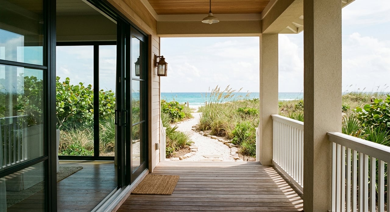
Ambersand Beach sits on Indian River County’s barrier island, which the county calls Orchid Island. This is not a broad suburban setting with standard lot assumptions. It is a narrow coastal environment where the beach and dune system play a major role in how land is used and protected.
Indian River County describes Ambersand Beach as a very small county beach park south of Sebastian Inlet with stabilized parking. That detail matters because it signals a more limited, development-sensitive stretch of coast. When you build here, you are planning within a setting shaped by shoreline movement, storm exposure, and public coastal access.
The surrounding area is also environmentally sensitive. Indian River County places the Ambersands Beach access within the Archie Carr National Wildlife Refuge area, and the U.S. Fish and Wildlife Service identifies the refuge as especially important sea turtle nesting habitat. For you as a buyer, that means the appeal of the location is tied not only to the water, but also to the natural systems that define it.
Start With the Parcel, Not the Floor Plan
One of the biggest mistakes buyers make with coastal land is falling in love with a house concept before fully understanding the site. On Ambersand Beach, the lot should lead the conversation. Design choices work best when they respond to the parcel’s elevation, dune condition, frontage, and exposure.
Indian River County notes that shoreline conditions in this area are not static. The county says the barrier island shoreline naturally retreats or advances over time, and that the beach and dunes act as the first line of defense against coastal storms. In other words, your lot is part of a changing coastal system, not a fixed backdrop.
That is why early due diligence matters so much. Before you spend too much time on interior layouts or finish selections, it helps to understand the build envelope, the physical site conditions, and what approvals may shape the final design.
Oceanfront vs Ocean-to-River Lots
If you are comparing parcels, the headline question is often whether a lot is oceanfront. That matters, but it is not the only factor. On this part of Orchid Island, the more useful question is how the parcel sits in relation to the beach, dunes, and lagoon side of the island.
An oceanfront parcel may offer direct coastal orientation and immediate proximity to the beach. An ocean-to-river parcel can create a different set of planning opportunities because the barrier island sits between the Atlantic and the Indian River Lagoon. Depending on the parcel, you may be thinking about access, views, site layout, and how to balance both sides of the island.
Neither option is automatically better. The right fit depends on your goals, the lot’s physical characteristics, and how much complexity you are prepared to manage during planning and construction.
Understand Erosion Conditions Early
This section of coastline is actively managed. Indian River County says erosion south of Sebastian Inlet affects Ambersand Beach, and the Sebastian Inlet District conducts sand bypassing in the area. The Florida Department of Environmental Protection’s 2025 critically eroded beaches report also places Ambersand within the northern critically eroded shoreline south of Sebastian Inlet.
That does not mean you cannot build here. It does mean you should go in with a realistic understanding of the setting. Shoreline conditions, dune health, and storm exposure should be part of the first round of site review, not an afterthought.
For custom buyers, this often shapes practical decisions such as building placement, elevation strategy, and how quickly you want your survey, site analysis, and permitting conversations to begin. In a place like Ambersand Beach, the parcel and the process are closely tied together.
Flood Zones Shape Design and Cost
Flood review is one of the earliest steps you should take when planning a custom build here. Indian River County says new FEMA Flood Insurance Rate Maps became effective on January 26, 2023, and county staff can help determine whether a property is in a flood zone. That gives you a good starting point before design work goes too far.
FEMA guidance says Zones V and VE are high-risk coastal areas with added wave hazard. It also states that flood insurance is mandatory for federally backed mortgages in high-risk A and V/VE zones. For you, this means flood zone classification can affect both design decisions and ongoing ownership costs.
There is some encouraging news as well. Indian River County says it participates in the National Flood Insurance Program Community Rating System at Class 5, which produced a 25% discount on flood insurance premiums in unincorporated Indian River County effective April 1, 2023. Even so, premium impact is still something to review early with your advisors.
Coastal Permits May Apply
On beachfront property, permit review often starts sooner than buyers expect. If a parcel is seaward of Florida’s Coastal Construction Control Line, the Florida Department of Environmental Protection says a permit is generally required for construction and excavation unless an exemption applies. That can influence your timeline well before final construction drawings are complete.
The purpose of CCCL jurisdiction is important to understand. DEP says it is intended to protect beaches, dunes, native coastal vegetation, public access, and marine turtles. In a location like Ambersand Beach, those priorities are part of the landscape, so your build plans need to work with them.
DEP also provides a Map Direct tool to help locate the CCCL on beachfront properties. Applications and supporting documents can be submitted electronically, but DEP notes that processing fees still need to be mailed or hand-delivered rather than paid online. That is a small detail, but it is a good reminder that not every step is fully digital.
Utilities Need Parcel-by-Parcel Review
Utilities are another item to verify early. Indian River County utilities say the county provides water and wastewater service to a major portion of the county, including Sebastian. At the same time, the county notes that some residents are served by private wells and septic tanks.
On the barrier island, utility service areas can also be shaped by interlocal arrangements. That means availability should be confirmed on the specific parcel before a design is finalized. You do not want to make major architectural assumptions before confirming how the lot will be served.
This is especially important for remote buyers who may be evaluating land from out of state. A beautiful parcel can still require a very practical utility conversation before the project is ready to move forward.
Remote Owners Can Manage the Process
If you are planning a build from outside Florida, the process can still be manageable with the right structure. Indian River County’s Building Division uses MyGovernmentOnline for plan review, permit submission, and inspections. That digital workflow can make a big difference when you are not local full time.
Still, remote does not mean hands-off. County and state processes show that many steps can be handled through portals, email, or electronic submission, but some payments, signatures, site visits, and inspections still need local coordination. That is where having a trusted local point person becomes especially valuable.
For many buyers, the smoothest path is to assemble the local team early. Survey work, permitting follow-up, builder scheduling, and site-based decisions all move more efficiently when someone local can help keep the process on track.
A Smart Planning Sequence
A successful Ambersand Beach build usually starts with the land, not the finishes. The more aligned your parcel, design team, and permitting strategy are at the beginning, the fewer surprises you are likely to face later.
A practical sequence often looks like this:
- Confirm the parcel’s physical characteristics and location context.
- Review flood zone status using current county map guidance.
- Check whether the property is affected by the Coastal Construction Control Line.
- Verify utility availability for that specific lot.
- Build your local team before design details get too far ahead.
- Organize timelines around permitting, site review, and inspections.
This kind of upfront planning is not about slowing things down. It is about helping your vision fit the realities of a rare coastal setting.
Why Local Guidance Matters
Ambersand Beach is a special opportunity, but it is not a plug-and-play homesite. You are balancing beauty, regulation, natural systems, and logistics all at once. The buyers who do best here usually approach the process with patience, clarity, and strong local guidance.
That is especially true if you are comparing oceanfront and ocean-to-river parcels, purchasing from out of state, or trying to understand how flood and permitting issues may shape long-term ownership. The more informed you are at the lot-selection stage, the better your custom build experience is likely to be.
If you are considering land or a custom-build opportunity on Ambersand Beach, Janyne Kenworthy can help you evaluate the parcel, the process, and the local considerations that matter most.
FAQs
What makes Ambersand Beach different from other coastal build locations in Indian River County?
- Ambersand Beach is part of a narrow, development-sensitive barrier island setting on Orchid Island, with dynamic shoreline conditions, dune systems, and habitat considerations that can affect planning.
What should you review first when planning a custom build on Ambersand Beach?
- You should start with the parcel itself, including elevation, dune condition, flood zone status, potential coastal permit requirements, and utility availability.
What does critically eroded shoreline mean for an Ambersand Beach buyer?
- It means this stretch of coast is recognized as erosion-prone and actively managed, so shoreline conditions and site planning should be reviewed early in the buying and design process.
What flood issues matter when buying land on Ambersand Beach?
- Current flood map status, whether the property is in a high-risk coastal flood zone such as V or VE, and how that may affect design, insurance, and mortgage requirements all matter.
What is the Coastal Construction Control Line on beachfront property in Florida?
- The Coastal Construction Control Line is a state coastal jurisdiction line, and if your parcel is seaward of it, construction or excavation generally requires DEP review unless an exemption applies.
Can you manage a custom build on Ambersand Beach from out of state?
- Yes, many steps can be handled digitally through county systems, but local coordination is still helpful for site visits, inspections, scheduling, and follow-up.
